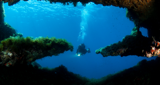
Often described as a diver’s paradise, Gozo is home to some of the top diving spots in the Mediterranean with a remarkable range of shore and boat dives. The island’s world class cave and tunnel dives, complemented by excellent light penetration, make any dive an event to remember. The island’s award-winning clean coast, and its array of scenic caverns, reefs, caves, and wrecks, make each dive an interesting one.
It is no wonder Gozo attracts divers from across Europe and beyond – all wanting to explore the sub-aquatic mysteries of this Mediterranean isle. Gozo has dive spots suitable for all levels of experience, from beginners to practiced divers looking for a new challenge.
Gozo Diving is famous for the underwater visibility, warm temperatures and stunning underwater scenery. Submerged caves, chimneys, arches and tunnels together with breathtaking drop offs and the flourishing marine life make Gozo a top diving destination. In fact, Gozo and Malta were recently voted the 2 nd best diving destination in the world by Diver magazine readers, making it the top place to dive in Europe. Beneath the surface of the sea, lies a magical and colourful world waiting to be discovered.
If you’ve already been diving in the Gozitan waters, you can understand clearly what we’re talking about. If you’ve never ventured into the spellbinding underwater world, this page will give you a faint glimpse of what we are talking about. WRECKS Decommissioned ships have been scuttled off Gozo’s South coast, near Comino’s Blue Lagoon and near Malta’s north coast. One wreck in particular was scuttled in shallow water purposely to be enjoyed by less experienced divers.
The sea is usually calm but the small size of the island means that you spend little time travelling between sites and if there is wind on one side of the island you are only minutes from an alternative dive-site. The sea temperature never drops below 14ºC so diving is possible almost all year round.
Gozo offers a wide range of dive centres with experienced, professional and qualified diving staff trained to teach all levels, from beginners to professional level according to Scuba Schools International (SSI), the Confederation Mondiale des Activites Subaquatiques (CMAS) and the Professional Association of Diving Instructors (PADI) standards. Dive centres are located across the Islands, so you will always find one near your accommodation. There is no need to bring your own equipment as centres provide all you need.
MORE INFORMATION36.036919° N 14.1859° E
Experienced
25m
40m
Directly underneath the high cliffs above, this near-vertical and sometimes over-hung wall is full of small holes and fissures inhabited by a variety of marine life. Massive boulders drop down into the depths creating small caverns and swim-throughs.
36.064555° N 14.184079° E
Experienced
36.0623° N 14.189293° E
Experienced
36.045031° N 14.187759° E
Experienced
36.053219° N 14.188596° E

Experienced
36.069585° N 14.183028° E

Experienced
36.080286° N 14.220364° E


Experienced
36.0116° N 14.2636° E
Beginner
6m
14m
This dive begins off a small rocky ledge 10m below the surface which soon falls down to a sandy bottom at 20m. Following the wall on the right hand side, the sloping seabed is mainly made up of neptune grass at first but further on the area becomes littered with huge boulders creating a couple of swimthroughs and providing shelter for a good variety of marine life.
36.047087° N 14.189140° E

Advanced
30m
60+m
This huge offshore rock at the entrance to Dwejra Bay has a big hole penetrating right through it, creating lovely reflections on the water at the base of the reef. Fungus Rock, otherwise known as ‘The General’s Rock’, got its name from a small, rare fungus that was discovered here by the Knights of St. John. This fungus was used as a remedy against various illnesses and was only allowed to be harvested by noble families. Fungus Rock was guarded closely by the Knights, who built an early form of cable car running to the mainland for easy access to their ‘treasure of drugs’. Underwater, the scenery is as dramatic as above, with vertical walls, fissures, gullies and caverns created by boulders lying against one another. The landscape more than makes up for the relative paucity of marine life.
36.0152° N 14.2760° E
Advanced
30m
50+m
Fessej Rock is a very dark and prominent rock rising about 15m above the surface of the water. The dive is a circumnavigation of the rock along a wall dominated by huge boulders and swim-throughs.
36.050252° N 14.186993° E
Advanced
35m
65m
This crocodile-shaped, low-lying rock can be seen approximately 150m offshore between Dwejra Point and Fungus Rock. Commencing from the sheltered side of the rock, this dive takes you westerly (towards the left of the rock) where a natural amphitheatre with near-vertical sides drops towards deeper water, reaching a steep wall directly below the seaward side of the rock. Continuing around to the right, there are a number of deep fissures inhabited by a variety of marine creatures. The bottom of the wall is littered with huge boulders, an excellent refuge for the many groupers in this area. The marine life here is prolific with damselfish, bogue, and salema dominating, while, as well as groupers, barracuda, tuna, dentex and amberjack are a common sight.
36.053132° N 14.188199° E
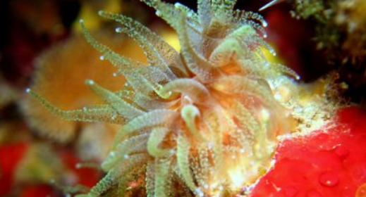

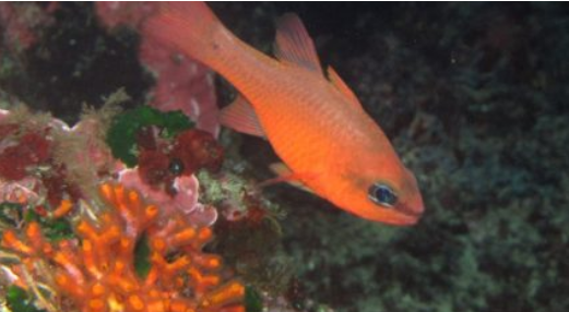
A stunning dive full of colour. The large entrance to this cave starts at a depth of 17m and stretches right down to the seabed at 28m where it is a good 30m wide. A tumble of boulders lie at the entrance but the cave’s floor is actually covered in silt, sloping up to 21m meeting the ceiling at the back. The walls and the ceiling of this magnificent cave are literally covered with different types of encrusting coral sponges, glass bell tunicates, yellow creeplets, orange sea fans, sand coral, gold cup coral, virgin lace coral and other small young corals with masses of cardinal fish and marine goldfish seeking refuge amongst them. It is very common to spot seahorses in this cave which adds another bonus to this fantastic dive. The view to the outside and the brilliant blue of the open sea is breathtaking.
36.01389° N 14.315979° E

Experienced
The reef here is clearly marked by a West Sector Cardinal Buoy. This is a wall dive mainly created by massive boulders among which there are cracks and fissures inhabited by a variety of fish.
36.0179° N 14.2723° E
Advanced
6m
14m
Starting from L-Għasri Valley, Cathedral Cave is located on the right hand wall just outside this spectacular narrow gorge. The entrance is only 5m below the surface and leads to a huge domed vault where you can surface in a very large air pocket, the ceiling of which is approximately 15m above water level. As this cave faces due west, it is best in the afternoon when it is brightly lit by direct sunlight. A small crack in the cliff face 2m above the water provides fresh air and adds to the light in the ‘dome’. At the rear of the cave, where the ceiling is only a metre above the surface, there is a shaft hewn from the rock going straight to the top of the cliff. This was once used, like a well, to fill the saltpans above. Today, however, this shaft is covered by a stone slab. The seabed in the cave is littered with huge boulders and the view of the blue of the ocean outside is breathtaking.
36.0824° N 14.2532° E
Advanced
30m
40+m
100m offshore due north of Marsalforn tower, this dive starts along the edge of a reef which is an underwater extension of the headland above. On the face of this vertical wall there are two narrow horizontal cracks at 21m and 30m through which divers can pass, finding themselves in a large cave. This cave extends for over 30m and emerges right in front of a spectacular natural archway. There is also a very large cave towards the west not far from Calypso Tunnel.
36.0163° N 14.2849° E
Experienced
30m
45m
The 80m long MV Ix-Xlendi, an old ro-ro ferry, was scuttled in November 1999 to form an artificial reef on Gozo’s south-east coast. Unfortunately, the wreck ended up upside down and due to the weight of the hull, the whole section above the deck was crushed. However, the MV Ix-Xlendi still offers a good dive for experienced divers. The propellers, one on each end, are found at approximately 32m and fish life is abundant all around the wreck. Wreck penetration is not recommended due to its very unstable condition. An old car lies next to the ferry on the coast side.
36.017275° N 14.285896° E
Experienced
30m
40m
The 58m MV Karwela, an old tourist ferry that once plied the Grand Harbour, was scuttled in August 2006 to form an artificial reef on Gozo’s south-east coast. This wreck stands perfectly upright and approximately 80 metres from the dive’s entry point. There is plenty to explore on its three decks. The top deck starts at a depth of 30m and the sandy bottom is at 40m to 42m. The nearby reef offers an excellent way to continue the dive, gradually ascending along the wall and providing a safety stop on the 5m-deep plateau above.
36.0173° N 14.2873° E
Experienced
30m
40m
The 39m-long MV Cominoland, an old ferry used for tourist day-trips round Comino, was scuttled in August 2006 to form an artificial reef on Gozo’s south-east coast approximately 80 meters from the entry point. The wreck stands perfectly upright and the two decks offer plenty of potential for exploration. The sandy bottom around the wreck is home to rays, gurnards and giant tuns. This wreck starts at 32m and the maximum depth around the Cominoland is 40m. The nearby reef offers an excellent way to continue the dive, gradually ascending along the wall with a useful safety stop on a plateau 5m below the surface.
36.0090° N 14.3231° E
Beginner
15m
20m
The P31 was built in the 1960’s in former East Germany as a Kondor Class boat designed as a minesweeper. She is 52m long and served as a patrol boat for the Armed Forces of Malta from the mid-1990’s until 2004. She was scuttled for divers in 2009 and lies perfectly upright on a sandy bottom at a maximum depth of only 20m., Ideal for Open water divers.
36.073886° N 14.262627° E
Experienced
The entry for this dive is close to an offshore rock rising about 5m out of the water. Until the mid-20th century, this rock was connected to the land, forming a spectacular archway above the sea. Historic black-and-white photographs show a boat passing through this arch. The dive itself is not particularly inspiring, but tiny moray eels and small octopuses are often found among the many small boulders littering the seabed. This site is generally used for training purposes.
36.0826° N 14.2356° E
Technical
37m
48m
On the western side of Reqqa Point, Bottleneck Cave drops down through the reef from 37m to 58m. The entrance hole at 37m, just large enough for a diver to swim through, soon takes the shape of a vertical cylinder about 5m in diameter. Along the walls of this cave are numerous cracks inhabited by various types of shrimp. At the deep end of the slightly sloping, sandy floor there is a narrow tunnel spectacularly leading out of the chimney to the bottom of the cliff. Looking up from this depth towards Reqqa Point is breathtaking. Because of the depth and condition of this chimney, this dive should be attempted by very experienced divers only.
Advanced
25m
Between these reefs and the shore, the rocky seabed is only 5 m deep and leads to a vertical drop-off. Precisely beneath the two rocks, there is an interesting cave (Roger’s Cave) with various small corals and sponges covering its sides and ceiling. Out of the cave, we follow the wall to the right around the bigger rock. Boulders of all sizes litter the seabed here, giving excellent refuge to many species such as the grouper and the brown meagre.
36.082044° N 14.235578° E
Advanced
20+m
70+m
This rocky promontory, jutting out several meters into the sea, is the most northerly point of Gozo. Underwater, the headland extends northwards for about another 50m. Surrounded by deep water, the vertical walls are cut by several fissures and crevices. Around the point of the reef, large boulders lying against the wall are an excellent refuge for groupers, octopuses, and large scorpionfish. To the east of the headland there is a chimney that drops down through the reef from 6m to 17m. To the west one can find Shrimps’ Cave. It is so called Shrimps’ Cave because in its cracks it is quite common to see shrimps
36.0169° N 14.2784° E
Advanced
12m
100+m
Ras il-Ħobż, otherwise known as Middle Finger, is best described as a huge column rising from the deep to end 8 metres below the surface. The narrow channel between this rock and the shore is 35 metres deep whereas on the seaward side, the bottom drops dramatically to 100+ metres. These features make this place a useful site for divers of all experience levels. A nearby plateau is just 5 metres deep, perfect for training or for making a prolonged decompression stop more interesting! At 63 metres, technical divers can find a huge 3-prong anchor protruding out from the reef wall. The whole site is also excellent for fish life.
36.053683° N 14.191077° E
Advanced
18m
40+m
A small enclosed bay at Dwejra Point is connected to the open sea through a large tunnel stretching approximately 80m. The walls on both sides are deep, vertical and overhanging for most of the way. This tunnel is only 6m deep at the start of the dive, immediately dropping down to 15m, and halfway through, the seabed is at 25m. The view as you look out into the deep indigo blue of the open sea is spectacular. Around the corner to both left and right, there are further vertical fissures and caves in the cliff face to be explored, while the marine life in this area is prolific.
36.027740° N 14.322343° E

Beginner
5m
15+m
An excellent spot for beginners to train, this is a sandy-bottomed bay with meadows of Neptune grass and a water pipeline running out towards Comino.
36.079174° N 14.248252° E
Beginner
15+m
45+m
This sheltered inlet is mostly used for training purposes. There is a very shallow entry over small banks of Neptune grass leading down to a series of rocky passageways. A small ledge drops down to a bottom that is sandy on one side and littered with pebbles on the other. Boulders of various sizes are found all around the seabed, ideal habitat for tiny moray eels and small octopi.
36.0298° N 14.2142° E
Beginner
6m
10m
On the northern wall of ix-Xlendi Bay, a very shallow tunnel opens up from the back of a Cave and runs right through the headland. Emerging from this tunnel, the cliff wall to the left leads towards the gentle outer drop-off and around the Reef, this extends underwater from the headland.
36.019475° N 14.289567° E
Beginner
15+m
40+m
This dive starts from a wide plateau 5m below the surface. This rocky ledge extends underwater and drops down to 35m. Most of this wall is formed by large boulders and fields of Neptune grass.
36.080286° N 14.243989° E

Beginner
12m
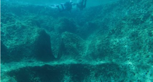
Walk between rock-cut saltpans to a small rocky inlet to find this interesting dive site. On the west side of the inlet are many large rocky canals, extending in irregular patterns for a couple of hundred metres, most probably formed by fresh water thousands of years ago. This relaxing, easy dive is ideal for padi open water divers.
36.075078° N 14.258614° E

Beginner
6m
10m
A gently sloping dive generally used for training purposes. The sandy seabed here is interspersed with large boulders and small beds of Neptune grass.
36.076910° N 14.252272° E
Beginner
6m
This is an easy dive suitable for beginners. The site features extensive beds of Neptune grass amongst small sandy patches.
36.018697,° N 14.272500° E
Beginner
5+m
15+m
This is a dive site where divers can encounter numerous species of fish which are rarely seen elsewhere. Mġarr ix-Xini is a great place for beginners and is especially popular for night dives.
36.050063° N 14.316004° E
Beginner
10m
10+m
This is an easy dive suitable for beginners. The site features extensive beds of Neptune grass amongst small patches of sand.
36.0260° N 14.3159° E
Experienced
This dive starts by entering a cave only 8m deep and about 6m high above sea level. However, after just a few meters in, the floor of the cave disappears, abruptly falling to a depth of 30m. Almost exactly beneath the entrance, a massive arch stretches down from 20m right to the seabed at 34m, making an ideal and spectacular exit from the cave.
Experienced
36.0590m
14.1910m
The second cavern is less long and is open right up to the surface. Boulders of all sizes litter the seabed.
36.079904° N 14.208326° E
Advanced
15+m
30+m
A rare chance to see seahorses as well as pristine corals. This dive starts from a brilliantly coloured cavern which is open right up to the surface and around 15m deep. Out of the cave, a steep wall to the right leads to a massive completely submerged cave full of pristine corals. It is well worth spending some time exploring here and there is an excellent chance of finding seahorses. The view to the outside blue of the ocean is breathtaking.
36.0754° N 14.1909° E
Advanced
25m
70+m
Wied ir-Raħeb, meaning ‘The Sacristan’s Valley’, is actually a dry gorge starting several hundred metres inland, ending up in the cliff-face about 25m above the surface. Although this dive is absolutely dominated by massive boulders, the fish life is not as abundant as one might expect. This dive is usually done as a drift-dive, entering 3 caves along the way. The walls of the first and third caves and the bottom are littered with colourful sponges and calcified coral. These caves are both open to the surface and are 15m and 25m deep respectively. The second cave, the ‘House Cave’, however, is the main attraction of the dive. The entry is a clean cut door in the cliff wall and the exit is a round window just above it. At the back of the cave, a very dark but wide chimney takes you up to water level where there is a small enclosed air pocket.
36.0131° N 14.2574° E
Advanced
25m
37m
At the bottom of the spectacular Ta’ Ċenċ Cliffs, the highest on Gozo, a small platform juts out from the headland at a depth of 8m. This allows for good anchorage and makes an ideal safety stop. Beyond the platform there is a steep drop-off and wall with some massive boulders at the bottom.
36.0765° N 14.1980° E
Advanced
25+m
35+m
The very sharp cliffs above the water here extend below the surface to the rocky seabed. Boulders of various sizes are home to a few groupers while the many fissures, cracks and small caves in the wall offer refuge to a variety of marine species.
36.0700° N 14.1806° E
Advanced
25m
60m
A very popular legend is connected with this site. An old hermit built a small chapel right at the edge of the cliff which he dedicated to Saint Dimitri. One day, a big chunk of the cliff collapsed sending the chapel to the bottom of the sea. However, the legend continues that this underwater chapel remains intact even today with a light burning in the window and that one can still hear the hourly chiming of the bell! The dive boat anchors in 6m of water on a shallow reef jutting out from a sheltered spike off the headland. A gentle drop-off leads to some massive boulders inhabited by a few groupers and dentex. Throughout this dive there is every chance of spotting large shoals of truly spectacular fish including barracuda, tuna, and amberjack. On the inside of the rocky ledge there is a gully between the reef platform and the shore which is very sheltered and filled with marine life.
36.0116° N 14.2636° E
Advanced
25m
60+m
A steep drop-off and wall with some areas covered in huge boulders. There are also two small caverns and an archway.
36.0040° N 14.3245° E
Advanced
30m
50m
The dive boat drops anchor on a rocky shelf 6m below the surface, very close to the entrance to a chimney. The chimney leads to a tunnel in the limestone plateau emerging at 16m where massive boulders drop down into the depths, creating huge caverns and swim-throughs.
36.0829° N 14.2229° E

Advanced
5m
40m
A steep drop-off and wall with massive boulders littering the seabed. There are also two caverns off to the east from the point.
36.0844° N 14.2472° E
Advanced
30m
45+m
This extended underwater rocky headland lies approximately 200m offshore. Two large archways have been carved through it by nature, creating one of the strangest and most impressive formations to be found in Maltese waters. The first, smaller archway starts at 27m and directly beneath it is the larger of the two, stretching to the seabed at 36m. There is prolific fish life here especially around the outer leg of the reef, including groupers and spectacular shoals of barracuda.
36.0794° N 14.2010° E

Beginner
6+m
20+m
In a sharp indent in the cliff off Hekka Point, is a massive cave above the water, with a big shaft in the ceiling going right to the top of the cliff. Starting the dive from this cave, which is only 6m deep, you can go out in a northerly direction to reach a rocky ledge dropping down to 20m. The seabed is completely covered with massive boulders.
36.079132° N 14.212998° E
Beginner
20m
50+m
The valley of Wied il-Mielaħ is rich in flora and a lovely place to walk especially in the autumn and spring. The way down the valley is like a botanical display of vegetation typical of the Mediterranean. Yellow rather than green is the primary colour here especially from late autumn until spring, when many fields bloom with the small yellow flower of the Cape Sorrel.
36.0260° N 14.3159° E
Beginner
5+m
10+m
Dramatic underwater scenery rewards the diver here (though relatively little marine life). The sheer cliff wall towering above the water, continues under the sea to a depth of 35m, where the seabed is littered with massive boulders. There are four caves here, two massive and clearly visible from the surface and two completely submerged. The latter are narrow caves starting at 20m depth that go straight into the cliff for about 40m and 50m respectively. The other two caves are much wider and penetrate the cliff wall for 120m and 130m. Right at the back of these two caves you can surface in a large air pocket totally enclosed by rock. On the way out of each of the four caves, the sight of the brilliantly blue and immaculately clear water is unforgettable.
36.0179° N 14.3407° E
Beginner
7m
10m
The dive-boat anchors in 10m of water, right above a wealth of gulleys, caverns, swim-throughs and caves. One cave extends over 30m all the way through the headland and connects to another cave. At the junction there is a big shaft open to the sky bringing in natural light. Throughout this dive, divers are mobbed by thousands of saddled seabream. The fish are expecting bits of bread, as this is a popular site for fish-feeding.
36.0452° N 14.3328° E

Beginner
6m
35m
Starting at around 6m, the reef here gradually slopes down to around 35m. The highlights of this dive are 5 huge anchors found amidst the boulders on the slope.
36.0236° N 14.2165° E
Beginner
15m
65m
The highlight of this dive is a large natural arch eroded from the surrounding cliffs. The wall drops down almost vertically at the beginning of the dive, giving way later on to massive boulders. There is also a large cave at the bottom of the archway.
36.053061° N 14.188834° E
Advanced
15m
25m
An iconic Gozo dive, the Blue Hole is reached by walking over ancient coralline limestone rocks with rough surfaces and some sharp edges. From the shore a shallow-water shelf leads out to an abrupt drop that is the Blue Hole. This natural rock formation resembling an upright tube has been carved out by thousands of years of wind and wave power. It offers a sheltered entry for this dive which takes you through a huge archway starting at 6m and stretching right down to the bottom at 15m. A large cave at the bottom of the hole, exactly opposite the archway, is also worth exploring. At the back of the cave is some spectacular scenery, making this area one of the most sought after dive sites in the Maltese islands.
36.081102° N 14.235318° E
Experienced
30m
35m
This large cave is located in a tight corner of a rocky coastline. Facing due north, it gets very little natural light. After swimming for about 60m into the cave over a bottom of fine sand and shingle, several loose boulders form an upwards slope leading to a second massive cave. Here you can surface in a large air pocket totally enclosed by rock. The ceiling of this cave is about 5m above the water level while the furthest walls are approximately 35m away. The sight on the way out of this cave – blue open water with the sun shining through from the outer reef – is very impressive.
36.0806° N 14.2420° E
Advanced
15+m
40+m
A submerged rocky ledge which starts just a couple of meters wide and then expands to around 150m towards the east. The depth on the plateau starts at 5 meters and at the most distant point is 15 meters. Two options are possible; either a dive down and along a vertical wall or an easy, relaxing dive on top of the plateau along the edge of the drop-off.


